Spatial Patterns of Seasonal Ridership, Built Environment and Social Demographics: A Taxonomy of Bike Share Toronto Stations

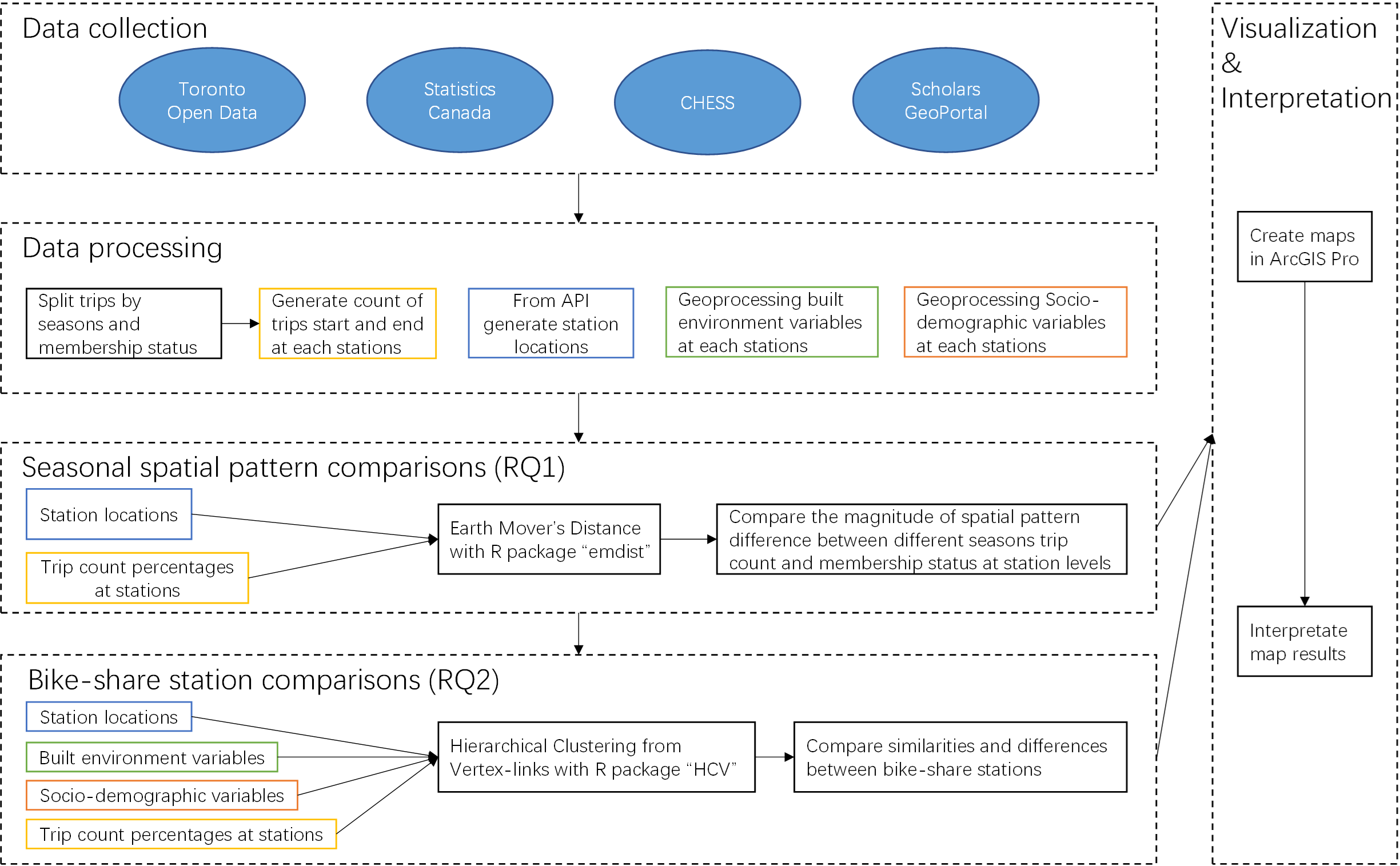
This project was completed as part of an advanced GIS course, GGRC30, taught by Dr. Elnaz Yousefzadeh Barri in the Fall of 2022. The project focused on the Bike Share Toronto system, and aimed to answer two research questions below through the use of Earth Mover’s Distance and Hierarchical Clustering from Vertex-links.
- RQ1. What are the seasonal spatial pattern differences in Toronto bike-share trips at station levels?
- RQ2. What are the similarities and differences between the locations, trip count percentages, built environments, and social demographics of Toronto bike-share stations?
The first research question sought to examine the seasonal spatial pattern differences in Toronto bike-share trips at station levels. Through the use of spatial analysis techniques, the project aimed to identify any patterns or trends in the distribution of bike-share trips across different seasons.
The second research question aimed to identify similarities and differences between the various bike-share stations in Toronto. The project analyzed a range of factors, including location, trip count percentages, built environments, and social demographics, to provide a taxonomy of the stations.
The project highlights the potential of GIS tools and techniques in analyzing and understanding complex spatial patterns and relationships. Through the analysis of the Bike Share Toronto system, the project provides valuable insights into the characteristics of the system and the factors that influence bike-share usage in the city.
You can find codes used in this project by clicking here.