Zehui Yin
| 殷泽辉
LinkedIn
Twitter
Github
ORCID
Google Scholar
Email
RSS
Data Analysis
Data Visualization
Data Visualization
Home
About Me
Curriculum Vitae
Projects
Data Analysis
Data Visualization
Research
Categories
All
(11)
Bikeshare
(2)
Central Limit Theorem
(1)
Dashboard
(1)
Digital twin
(1)
Gainesville
(1)
Hamilton
(2)
Nanjing
(2)
Public transit
(2)
Real time
(4)
Shiny
(2)
Simulation
(1)
Spatial analysis
(1)
Static map
(2)
Toronto
(3)
Web map
(7)
Data Visualization
Order By
Default
Title
Date - Oldest
Date - Newest
Tissot Circles in Different Coordinate Reference Systems
Static map
A coordinate reference system is a crucial component for geographical data. It governs how spatial features are placed and aligned on the map. Tissot circles are an excellent way to demonstrate distortion in different coordinate reference systems.
Nov 3, 2024
Hamilton Street Railway Real Time Web Map
Hamilton
Public transit
Real time
Web map
Shiny
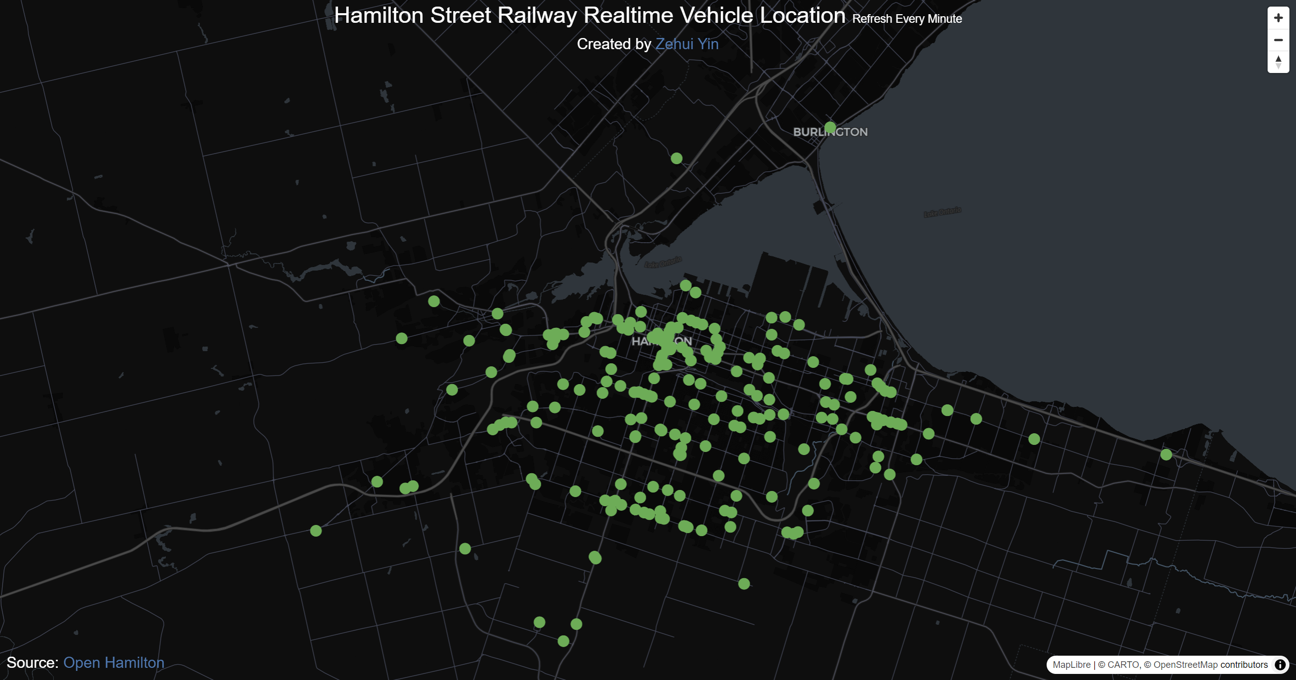
This Shiny app provides real-time locations of Hamilton Street Railway transit vehicles. Sourced from Hamilton’s open data using GTFS real-time feeds, the vehicle locations…
Oct 9, 2024
Hamilton Demographic Maps
Web map
Hamilton
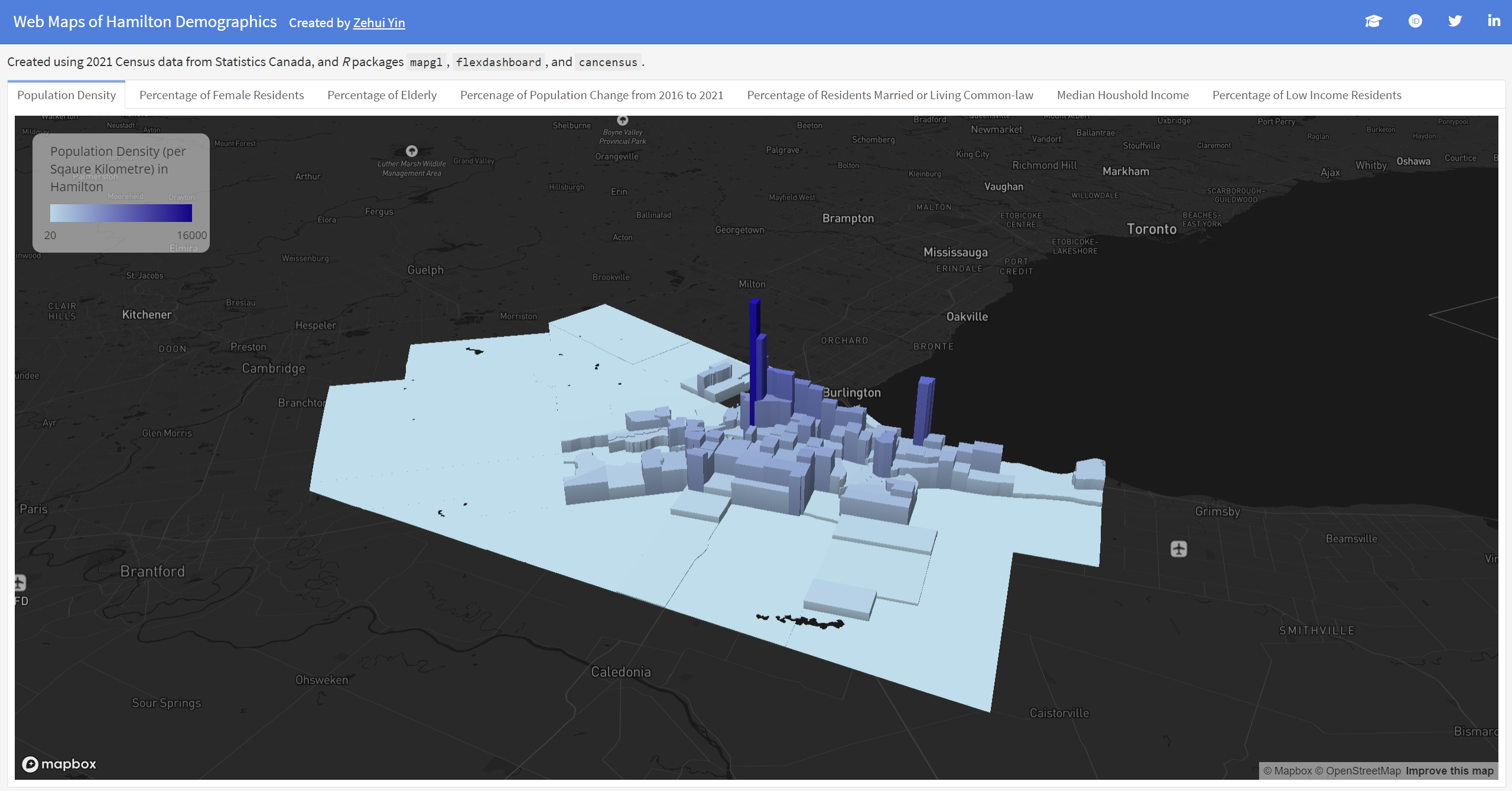
This series of web maps illustrates Hamilton’s demographics, sourced from the 2021 Canadian Census by Statistics Canada.
Oct 7, 2024
Earthquake Dashboard
Dashboard
This dashboard visualizes the location and magnitude of all the earthquakes that occurred in the past week. The data is sourced from the USGS, which provides real-time GeoJSON feeds of seismic events around the world.
Nov 17, 2023
Central Limit Theorem Demonstration
Central Limit Theorem
Simulation
Shiny
Central Limit Theorem demonstration based on simulation: a pure frontend Shiny app using Shinylive.
Nov 15, 2023
Toronto Bikeshare Station Info Web Map
Toronto
Bikeshare
Real time
Web map
This web map shows the latest information about the bikeshare Toronto stations, such as their address and capacity.
Aug 6, 2023
Toronto Transit Commission Real Time Web Map
Toronto
Public transit
Real time
Web map
This web map displays the real-time location, direction and speed of each Toronto Transit Commission (TTC) vehicle. The map updates every minute at most.
Jun 30, 2023
Toronto Bike Share Web Map
Toronto
Bikeshare
Spatial analysis
Web map
This web map shows the results of two spatial analysis projects on Bike Share Toronto stations and routes
Jun 26, 2023
Digital Twin with Real-time Transit Data: UF Campus with RTS
Digital twin
Real time
Web map
Gainesville
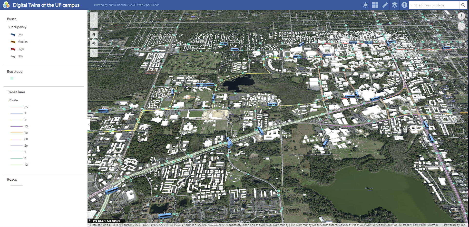
This project creates an ArcGIS Online web app with a 3D map which focuses on the UF campus. The 3D map contains the 3D models of the buildings on the UF campus, city roads…
Jun 22, 2022
Map of Nanjing Tourist Attractions and Ticket Prices
Nanjing
Web map
This web map, created using ArcGIS Online, was the final project for my first-year GIS course
GGRA30
, which was taught by
Dr. Haydn Lawrence
in the winter of 2021.
Apr 20, 2021
Admission Universities of High School Classmates
Nanjing
Static map
As a parting gift for my high school classmates and teachers, I created a heat map showcasing the universities they were admitted to in the year 2020. The map, written in…
Jul 20, 2020
No matching items